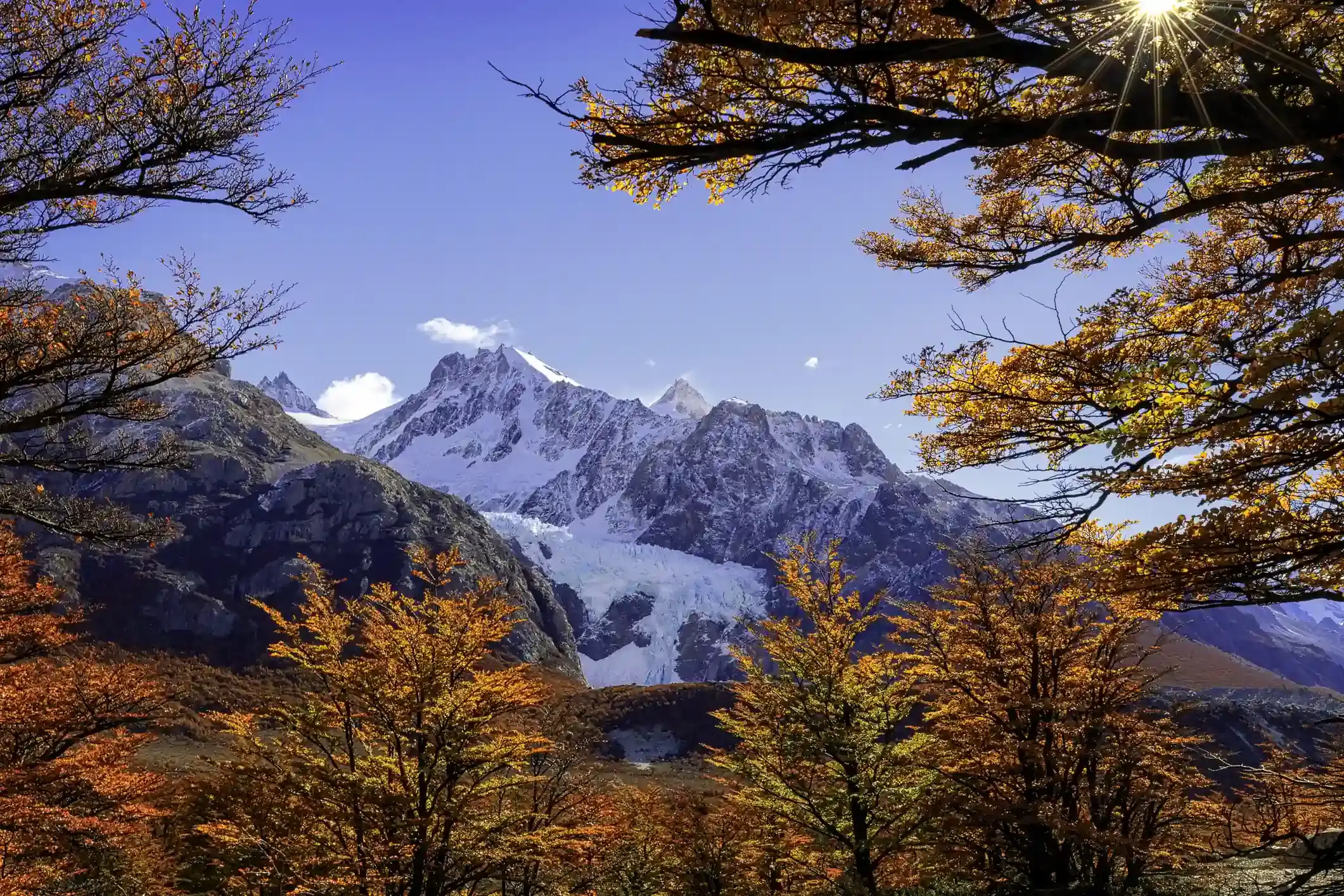
A glacier and snow-covered peaks framed by autumn beech forest
Andes Crossing route

Bariloche to Pampa Linda: the Tronador gravel road and the black glacier

The out-and-back day: 30 km of pavement to Lago Mascardi, then 30 km of one-way gravel through the forest to Pampa Linda, under the three summits of the Tronador and the black glacier below them.

Bariloche out to Pampa Linda and back the same way, the last riding day of our Andes Crossing. Data computed 2026-10-20, notes updated 2026-10-21.

  • 62 km39 miles
  • 47 % paved29 km gravel, 4 km untagged
  • 950 mhighest point, 588 m of climbing
  • 11 fuel stopslongest gap 32 km
  • 1 to 1.5 hriding time, stops not included
  • 14 windy daysgusts over 60 km/h in Jun
50 km 0: YPF, San Carlos de Bariloche km 0: YPF, San Carlos de Bariloche km 0: Axion, San Carlos de Bariloche km 0: ACA, San Carlos de Bariloche km 1: Puma, San Carlos de Bariloche km 1: YPF, San Carlos de Bariloche km 2: YPF, San Carlos de Bariloche km 2: Puma Energy, San Carlos de Bariloche km 3: Axion, San Carlos de Bariloche km 30: Lago Mascardi, Lago Mascardi km 30: ACA Lago Mascardi, Villa Mascardi San Carlos de Bariloche Pampa Linda
Route traced on real roads with OSRM; orange dots are fuel stations within 1.5 km of the road, numbers are kilometres from the start. Open the area in OpenStreetMap.
773 m 862 m 950 m San Carlos Lago Mascardi 0 km 62 km
Elevation every kilometre (SRTM via Open-Meteo), from 773 to 950 m. Dashed lines are fuel stations.

What this stretch is

The Tronador is the mountain that dominates the southern Nahuel Huapi, a 3,478 m extinct volcano on the Chilean border with glaciers on every face. The road to its foot leaves Ruta 40 at Villa Mascardi, 30 km south of Bariloche, and runs west along Lago Mascardi and up the Río Manso valley to Pampa Linda, a clearing with a hostería and a campsite where the road ends. It is 62 km from Bariloche, and then 62 km back, because there is no other way out.

OpenStreetMap tags 29 km as paved, the Ruta 40 part, and 28 km as gravel, the park road. The gravel is narrow, forested and mostly in good condition, with the climb to the Los Rápidos viewpoint and a few blind corners above the lake. The segment tops out at 950 m.

The one-way schedule

The park road is too narrow for two-way traffic on most of its length, so Nahuel Huapi national park runs it in one direction at a time: inbound in the morning, outbound in the afternoon, with a changeover around the middle of the day. The exact hours change by season and are posted at the park gate at Los Rápidos; plan to be at the gate when it opens inbound and to leave Pampa Linda when the outbound window starts. Arriving at the gate at the wrong hour means waiting, not riding. There is a park entrance fee, paid at the gate.

Fuel: fill in Bariloche

Eleven stations, nine of them in Bariloche in the first 3 km and the ACA at Villa Mascardi at kilometre 30. From Mascardi to Pampa Linda and back is 64 km without fuel. Fill in Bariloche and the day is trivial on any tank; the fuel range calculator shows it as comfortable, and the Mascardi pump is the backup on the way out.

The weather

The climate point for this segment is near Lago Mascardi: January highs of 21 °C with eight rainy days, 15 in April and 18 in July. Wind is moderate on the lake, 10 to 12 gusty days a month year round, but the valley road is sheltered. Snow closes the road in winter, with one snow day a month in July at the lake and far more higher up; the park opens the road to Pampa Linda from spring to autumn. The rideable window on the numbers runs from November to April.

Stops and detours worth the time

Lago Mascardi and Los Rápidos. The viewpoint above the lake where the gravel starts, and the park gate.

Cascada Los Alerces. A side road near the junction leads 14 km to the waterfall on the Río Manso; a worthwhile detour on the way out if the schedule allows.

Ventisquero Negro. Seven kilometres beyond Pampa Linda, at the end of the road, the black glacier: a tongue of ice covered in rock debris calving into a grey lake, with the Tronador’s walls above. The Garganta del Diablo waterfall walk starts from the same car park and takes an hour.

Pampa Linda. The clearing has a hostería with lunch and a campsite, and is the base for the Otto Meiling refuge trek up the mountain, which is a full day on foot and not on this itinerary.

Where to sleep

Our itinerary returns to Bariloche. If you want the mountain in the evening light, the Hostería Pampa Linda has rooms and is the only roof at the end of the road; book ahead in summer.

Riding it with us

The Tronador is the last riding day of our Andes Crossing: short, gravel, and the biggest mountain of the trip, with the farewell dinner in Bariloche that night. Read our tips for navigating the Andes for riding narrow gravel in a group, and the top 3 motorcycles for off-road adventure riding if you are choosing a bike with roads like this in mind.
Fuel stations and gaps

Stations mapped in OpenStreetMap within 1.5 km of the road, with the kilometre from San Carlos de Bariloche. Hours are what OSM has, often nothing. Check this segment against your tank.

kmStationTownHours (OSM)
0YPFSan Carlos de Bariloche
0YPFSan Carlos de Bariloche24/7
0AxionSan Carlos de Bariloche
0ACA (YPF)San Carlos de Bariloche
1PumaSan Carlos de Bariloche
1YPFSan Carlos de Bariloche
2YPFSan Carlos de BarilocheMo-Su 12:00-00:00
2Puma Energy (Puma)San Carlos de Bariloche
3AxionSan Carlos de Bariloche24/7
30Lago Mascardi (Aca)Lago Mascardi
30ACA Lago Mascardi (YPF)Villa Mascardi
  • 32 km Villa Mascardi (km 30) to Pampa Linda
  • 27 km San Carlos de Bariloche (km 3) to Lago Mascardi

Surface and roads

Kilometres by the surface tag of each road in OpenStreetMap. "Untagged" is road nobody has labelled yet, usually recent asphalt on main routes and gravel on minor ones.

  • Paved 29 km
  • Gravel and dirt 29 km
  • Untagged 4 km

Roads, by length: RN40 26 km; A cascada Los Alerces 14 km; RP81 9 km.

Weather by month, ten years measured

ERA5 reanalysis, 2016 to 2025, at a point halfway along the segment (-41.33, -71.50). Temperatures are the monthly mean of the daily high and low; wind is the mean daily maximum; gusty days count days with gusts above 60 km/h. The riding window on these numbers runs Nov to Apr, with Feb the calmest month inside it. Compare regions in the season planner.

MonthHigh °CLow °CWind km/hGusty daysRain daysSnow days
Jan 21 9 15 11 8 0
Feb 21 9 14 8 9 0
Mar 18 7 13 10 11 0
Apr 13 5 12 11 15 0
May 10 3 11 10 16 0
Jun 6 2 12 14 19 1
Jul 6 1 11 11 18 1
Aug 7 2 12 13 18 1
Sep 8 2 12 9 14 0
Oct 11 4 13 11 15 0
Nov 14 5 13 10 12 0
Dec 18 7 15 12 10 0
Read before you ride

Guides for this road

Motorcycle on a gravel road through a rocky Patagonian canyon under clear blue sky. Patagonia

The Best Time to Ride Patagonia: Month-by-Month Guide

In early January, the wind on the southern stretch of Ruta 40 between Perito Moreno and El Calafate can push a fully loaded adventure bike sideways across half a lane, in broad daylight, on dry...

12 min read
A motorcycle rider on a paved road approaching the red rock formations of the Quebrada de las Conchas near Cafayate, Argentina. Tips

How to Plan a Motorcycle Trip to Argentina: A 2026 Guide

Somewhere around the third planning session, every rider runs into the same wall: Argentina is 3,700 km (2,300 mi) long from the subtropical north to Tierra del Fuego, the riding seasons in those...

14 min read
Ride it with the van behind you

This is a day on our Patagonia itinerary.

Small groups of 4 to 8 riders, a support van with spare fuel for the Bajo Caracoles gap, and guides who know which pump is open this week.