
Introduction
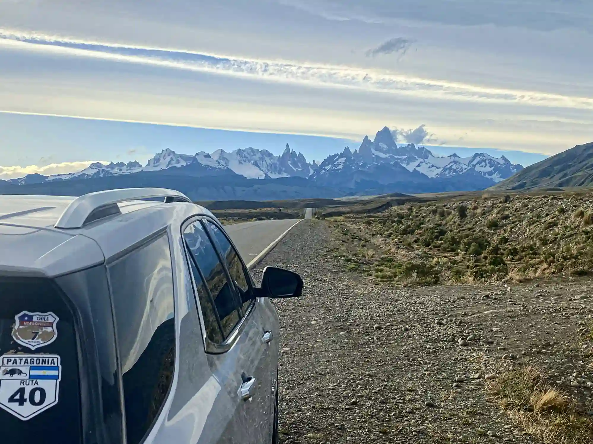
Ruta 40 runs the length of Argentina, from La Quiaca on the Bolivian border down to Cabo Vírgenes at the Strait of Magellan. It crosses 11 provinces, climbs over 5,000 m (16,400 ft) at its highest point, drops to sea level on the southern coast, and stitches together every kind of terrain in the country, from Andean altiplano to Patagonian steppe to lake-district rainforest. For an international rider, it is the road that defines an Argentina motorcycle trip, and most riders who plan one trip back here for a second.
This is a rider's guide to Ruta 40 with the practical detail you need to plan a real trip: what the road actually is, what surfaces you'll meet, when to come, how to deal with the long fuel and lodging gaps, and why the most rewarding way to do the iconic stretches is in a group with a local guide. The argument we'll make at the end is simple: the best stops on Ruta 40 aren't on Google Maps, and the only way you find them is to ride with someone who already knows the road.
What Ruta 40 actually is
The full arc: 5,000 km from north to south
The full Ruta 40 covers roughly 5,194 km (3,228 mi), which is longer than the entire west coast of the United States or the distance between Madrid and Tehran. It is the longest national route in Argentina and one of the longest single roads in the world. Riding the whole thing, end to end, takes most riders three to four weeks of dedicated saddle time. Few international visitors ride the whole length on a single trip; most pick a section that fits the time and the riding style they want.
The road runs roughly parallel to the spine of the Andes, at an average distance of 100 to 200 km (62 to 124 mi) from the cordillera. It crosses 11 provinces in its length: Jujuy, Salta, Tucumán, Catamarca, La Rioja, San Juan, Mendoza, Neuquén, Río Negro, Chubut, and Santa Cruz. Each province has its own character, surface conditions, weather window, and culture. Treating Ruta 40 as a single road in your planning is a mistake. It's a chain of very different rides linked by a number on a map.
The northern third (Jujuy through Mendoza) sits in the high Andes, with passes over 4,000 m (13,100 ft), Quebrada-style canyons, vineyards in Cafayate, and the wine country around Mendoza. The middle third runs through the dry desert and mountain regions of San Juan and Mendoza into northern Patagonia. The southern third, from Bariloche to the Magellan coast, is the most-photographed stretch and the one most international riders come for. Each third has its own logistics and riding character, and the choices you make about which third to tackle drive everything else about the trip.
The Patagonian stretch: where most international riders go
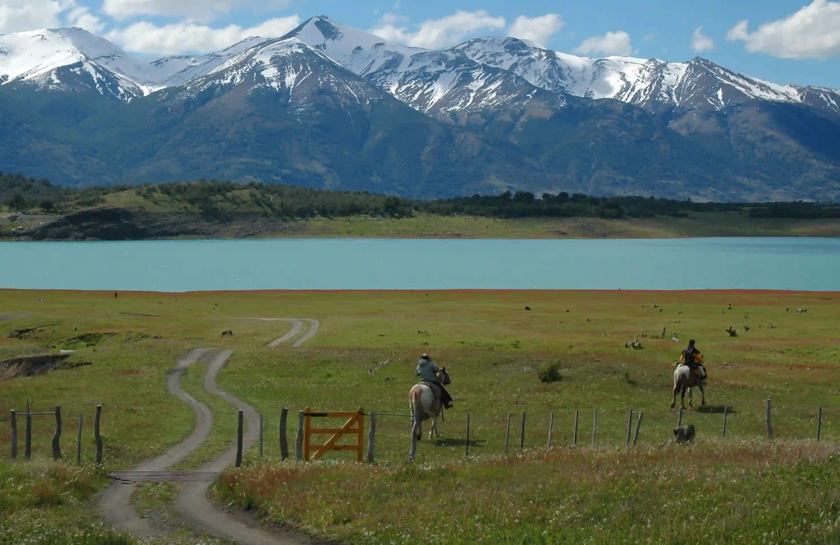
For riders flying in from the US, Canada, UK, Western Europe, Australia, or New Zealand, the Patagonian stretch from Bariloche south to Río Gallegos is the section that best fits a 10 to 14-day trip and delivers the iconic photographs. It runs through the Lakes District around Bariloche, drops onto the Patagonian steppe, passes the Cueva de las Manos area, and ends near the southern coast. Total distance from Bariloche to El Calafate is about 1,400 km (870 mi), enough to fill a real trip without rushing.
This stretch is also the one with the most demanding logistics. Fuel gaps push 200 km (124 mi), towns are small and far between, lodging fills up in summer, and the wind on the southern steppe is among the strongest sustained wind any rider will meet in the world. The reward is that this stretch is also where Ruta 40 looks most like the version riders have in their heads: open road, dramatic light, and almost no traffic. We cover the regional weather windows and timing in our best time to ride Patagonia guide.
What riding Ruta 40 actually means
Surfaces: pavement, ripio, and the parts that change every year
Ruta 40 is mostly paved today, but calling it "all paved" is misleading. Long stretches in the south, particularly between Perito Moreno (the town) and Tres Lagos, were paved relatively recently and the surface quality varies. Construction zones, gravel detours, and sections that revert to ripio after winter freeze-thaw are common. A current paving project might be a fresh hot-mix in March and a 30 km gravel detour by April.
The northern Andean stretches in Jujuy and Salta have several gravel sections and historic dirt-track segments, especially on side roads off the main route. Plan for ripio if you're going north of Cafayate. Tire choice matters more than most riders realize. A 50/50 dual-sport tire handles the whole route comfortably; a road-biased tire on heavily abused gravel (loose surface plus washboard plus the occasional pothole the size of a soup pot) is a recipe for low-sides.
Weather, season, and wind
The riding season splits along the route. The northern stretches (Jujuy to Mendoza) are best from September to April, with summer (December to February) being hot but rideable; high-altitude passes can hold snow into October. The southern Patagonian stretch is the opposite: November to early April is the practical window, with January and February being peak in every sense, including the wind. The best time to ride Ruta 40 end to end, if you're going for the whole route, is March, when the north is past its summer peak and the south is still warm.
Wind is the single weather factor that surprises first-time riders most. On the steppe between Perito Moreno and El Calafate, sustained winds of 60 to 80 km/h (37 to 50 mph) with gusts over 100 km/h (62 mph) are normal in summer, on dry pavement, in broad daylight. The wind comes from the west and pushes a fully loaded adventure bike sideways across half a lane on bad days. Riding into a strong crosswind for six hours is exhausting in a way that punches above what the numbers suggest.
Temperatures vary widely by latitude and season. The northern sections can hit 35°C (95°F) in summer; the southern sections rarely exceed 25°C (77°F) and can drop to single digits Celsius overnight even in January. Pack for a 30°C (54°F) range in any single trip, with layers you can shed and pile back on without taking gloves off. Our Andes navigation tips cover the on-the-ground variables in more detail.
Fuel, lodging, and the long gaps
The stretches that punish unprepared riders are not the famous ones. Bajo Caracoles is the most discussed fuel gap in South American adventure riding: it's the only fuel for roughly 350 km (217 mi) on Ruta 40 between Perito Moreno and Tres Lagos, the pump can run out in peak season, and lining up behind a queue of tour-group adventure riders is a normal part of the experience. Carrying 5 to 10 liters of spare fuel through this section is standard practice for solo riders.
Lodging is the second pinch point. Small towns along Ruta 40 have limited hotels, hostels, and cabins, and they fill up in summer. three to four months ahead for January and February, especially in El Chaltén, Los Antiguos, and El Calafate. Outside that window, lodging is easier but seasonal businesses close down, and you can find yourself in a town where the only hotel is shut for the winter.
The case for riding Ruta 40 in a group
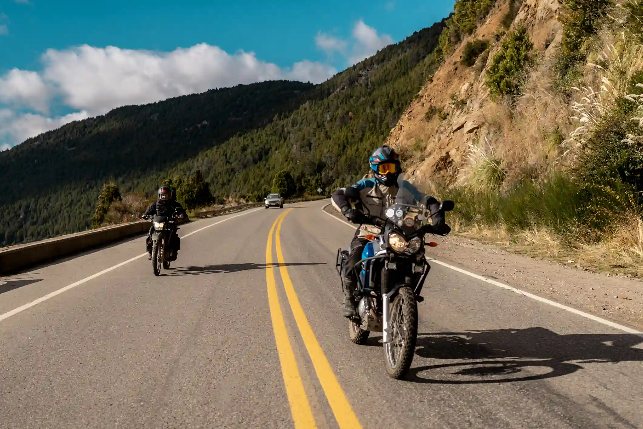
Safety, mechanical backup, and pace
The first argument for a group is the simplest one: a fallen rider on Ruta 40 is rarely close to anyone. Distances between towns, cell coverage gaps that stretch for hours, and a road network that doesn't have the kind of emergency response infrastructure most international riders are used to mean that solo crashes have higher consequences here. Riding with two or three other bikes in sight changes the math substantially.
Mechanical issues compound the same way. A flat tire 200 km from the nearest town becomes a different problem alone than it does with three bikes carrying the same set of tools and a chase vehicle within radio range. Tour-grade groups carry tube spares, plug kits, a 12 V compressor, basic torque tools, and a working radio. Solo riders can carry the same gear, but the mental load of fixing an issue in a 35°C wind with no backup is meaningfully different.
The fatigue and decision-load math
Long-day riding on Ruta 40 wears riders down in ways that are not obvious before the trip. Wind, sun, altitude, and constant low-level vigilance add up to fatigue that compounds across days. By day six or day eight, the rider's reaction times and judgment are noticeably worse than at day one, and most rider mistakes on this kind of trip happen in the second half of the trip rather than the first.
Riding in a group distributes the navigation load, the fuel-stop math, the lodging coordination, and the food decisions across multiple people. One rider plans the morning, another handles the lunch stop, a third sorts out the night's beds, and the cumulative cognitive load on each rider drops by a multiple. That sounds like a small thing on paper. In practice, on day eight of a hard trip, it's the difference between a rider making good decisions and a rider too tired to make any.
The pace question is the third piece. A group of three to six riders on similarly capable bikes will average about the same speed as a solo rider, but with better stops, more dynamic conversation, and a built-in audience for the moments that make the trip. Riding solo for two weeks straight is a particular kind of experience and worth doing once. For most riders making one Argentina trip, the group format gets more out of the same number of days.
The case for hiring a local guide
Why the best stops aren't on Google Maps
Here is the argument the article hinges on, and it's a real one. The most rewarding stops on Ruta 40 are not on Google Maps and not in any guidebook. They're the dirt road off the highway where a small estancia keeps a kettle on for passing riders. The viewpoint behind the third hill that nobody bothers to mark because it's not on the way to a famous landmark. The fuel station owner in a town of 200 people who can tell you which back road to El Bolsón has been graded that week.
Google Maps shows you the road. It doesn't show you which side road leads to a working estancia where a rider can stop for a hot mate, which canyon viewpoint sits behind the hill that's not on the way to a famous landmark, or which small-town fuel station has the best chance of having gas at 8 pm in February. Those are the kind of details that change a trip, and they live in the heads of people who ride this road month after month. Our top hidden routes for motorcycle adventures in Argentina post covers a few of these explicitly.
Border crossings, paperwork, and language
Argentina-Chile crossings on or near Ruta 40 (Cardenal Samoré, Paso Roballos, Paso Río Mayo) are straightforward in good weather but full of small administrative details that can become problems if you're not prepared. Carnet de Passages, vehicle title, liability insurance, and customs paperwork all need to be present in the right order, and a missing document can mean a turnback. A guide handles this routinely; a solo rider on their first South American trip handles it with a much higher error rate.
Spanish makes a real difference too. Most rural police and small-town hotel staff don't speak English, or speak only the basic kind that breaks down quickly when something needs to be discussed in detail. A rider with conversational Spanish handles this fine. A rider with no Spanish, especially at a roadside police check or with a mechanical problem at a remote fuel station, is in a different position.
The third paperwork variable is the unexpected one. Provincial road closures and weather-driven detours are normal in Argentina, and the information often travels by word of mouth among local riders, hotel owners, and border officials hours before it appears on any official channel. A guide hears these things in real time. A solo rider on a tight schedule might find out at the closure itself.
The trip-planning load
Designing a 10 to 14-day Ruta 40 trip from scratch is a real project. Route planning, lodging bookings, fuel calculations, weather windows, bike rental or shipping logistics, and contingency plans for the most likely failure modes add up to dozens of hours of pre-trip work for a rider doing it for the first time. For repeat South America visitors, the planning load drops. For a first-timer, it doesn't, and a lot of the planning ends up suboptimal because the rider doesn't yet know the on-the-ground reality.
A guided trip moves all of that to someone who runs the same route monthly and knows the variables that don't show up in research. The logical comparison is not "guided vs. independent at the same cost" but "guided vs. an independent trip that takes 60 hours of pre-trip planning, ends with one or two avoidable mistakes, and costs roughly the same once you account for lodging mix-ups and route corrections." For most riders making one Argentina trip, the math favors the guided option. Our 5 reasons to join a guided motorcycle tour in Argentina and Chile post lays out the trade-offs in more detail.
Conclusion
Practical takeaways
Ruta 40 is not a single road but a chain of very different rides linked by a route number. picking the section that matches your time and riding style, not with trying to ride the whole thing. The southern Patagonian stretch is the international classic. The northern Andean stretch through Salta, Cafayate, and Mendoza is the second strongest pick and offers a different kind of riding (higher altitude, drier, more wine country, more pre-Columbian culture).
The practical variables that drive a successful Ruta 40 trip are season, wind, fuel gaps, lodging availability, and surface conditions. Plan for the wind and the gaps; plan for everything else around them. Bring a 50/50 dual-sport tire. Pack layers for a 30°C range. Book lodging three to four months ahead in summer. Carry spare fuel through Bajo Caracoles. Ride during the right window for the section you're tackling. Most planning failures on Ruta 40 are concentrated in those five variables.
The third-order argument is the one we'd defend hardest. Riding Ruta 40 with a group, with a local guide, gets you a better trip in the same number of days. The safety case is real, the mechanical-backup case is real, the fatigue and decision-load case is real, and the access-to-local-spots case is the one that most often surprises riders who came in skeptical. The version of Ruta 40 most riders see on their first trip is a different version from the one that locals ride, and the only path between the two is to be on a bike with someone who knows the road.
Final thoughts
If you've been thinking about riding Ruta 40 for years, the answer to "is it worth the trip" is unequivocally yes. delivers everything riders hope for from a long trip, and then some. The follow-up question is the one this article has been answering: how to ride it well, given the constraints of a real rider with a real number of vacation days, who only gets to do this once or twice in a lifetime.
If you want help thinking through which section, which season, and which format makes sense for your specific trip, take a look at our Patagonia motorcycle tours for the southern stretch, our Andean Highlands tour for the northern Andean section, or get in touch to plan something custom around the Ruta 40 stretch you have your eye on. We usually reply within a day, and we'll tell you what we'd actually do in your window, not just what we'd like to sell you.